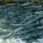
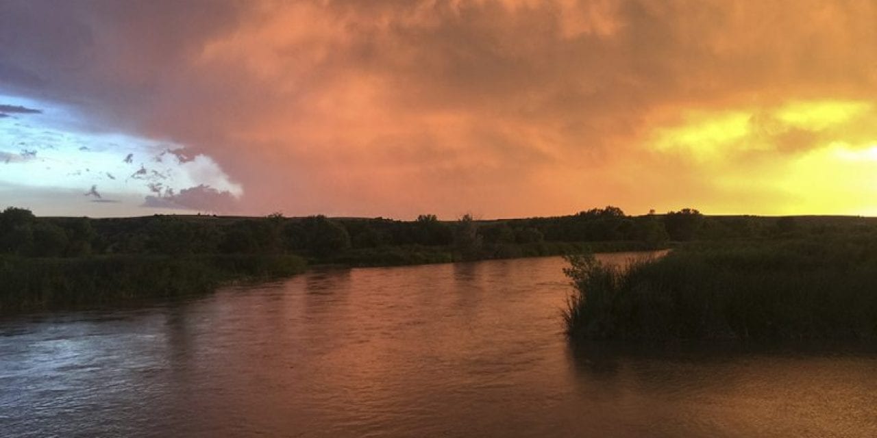
“Day 52: Last night we nearly got flooded out of our camp on a mid-river sandbar, the rising water caused either by upstream rains, hydro-cycling from the nearby Columbus power plant, or both. Today, Pete and I paddled 33 long miles. We had an easy float in the morning, with a deep current cutting along the bluffs near Fremont, and we passed the sacred Pawnee Indian site ‘Pawhuk.’ Man, you could feel a strong spirit on the river there…But this afternoon 30+ mph headwinds and a shallow, elusive channel made it one of our hardest canoeing days so far. We are exhausted. The silver lining was we counted 20 bald eagles, a dozen federally endangered least terns, three large flocks of pelicans, two muskrats, a water snake, and Pete may have just found a fossilized bison horn. And now, there is this amazing orange-pink sunset. Every day writes its own chapter on the river.” –Field journal, August 21, 2016
On July 1, 2016, my filmmaker friend Pete Stegen and I had set out on what we called a braided journey: traveling by bike, backpack and canoe 1,300 miles across our home watershed, the Platte River Basin, a 90,000-square mile geography that stretches from the Rocky Mountains of Colorado and Wyoming through Nebraska in the heart of the Great Plains.
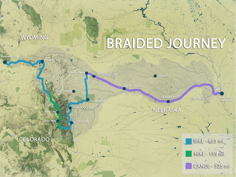
I had penned the idea on the back of a napkin several months earlier, not really believing it would happen, but then there we were, standing with our bikes and cameras in a lush green meadow of grass and sage at the southern base of the Wind River Range in Wyoming, near Sweetwater Gap, the furthest western source a drop of water comes from in the Platte River as it makes its way downstream to the Missouri River along the Nebraska-Iowa border and eventually to the Gulf of Mexico.
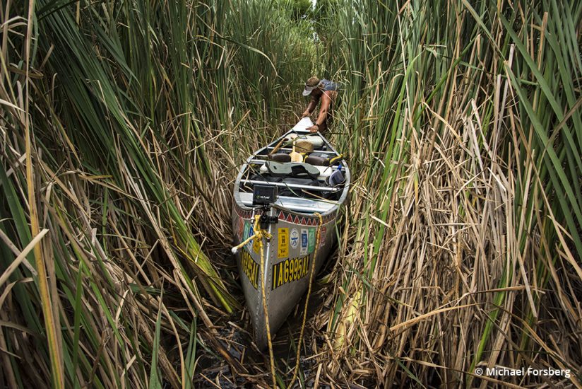
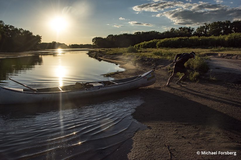
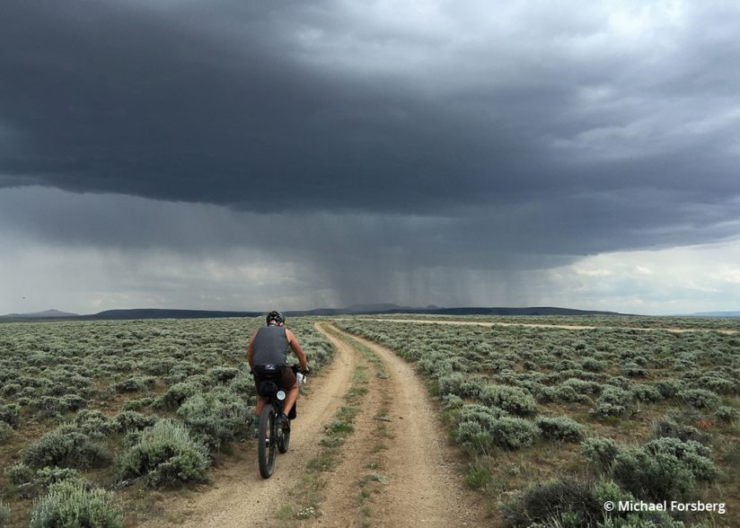
Over the next 55 days, we would log 650 miles by bike, 160 miles by foot and 525 miles by canoe. We would pedal through the vast sagebrush sea along the Oregon Trail to Pathfinder Dam and the North Platte River, through the heart of Denver and across Colorado’s eastern high plains. We would backpack through blankets of alpine wildflowers and hop over headwater streams of the South Platte River along the craggy spine of the Continental Divide in Colorado’s Front Range, and we would paddle, push and drag our canoe down the braided sandy channels and around irrigation diversions of the Platte all the way across Nebraska. We weaved through wilderness and countryside and urban core and back out again.
Our goal was to personify a drop of water as it washes through our landscape and see how it connects with our lives, moving only as fast as our legs would carry us or the river would take us, and to document the journey with cameras in hand along the way.
Our mission was part of a bigger vision called the Platte Basin Timelapse project, PBT, co-founded by myself and my friend and colleague Michael Farrell, in partnership with the University of Nebraska, and with a number of collaborators and supporters across the basin. Since 2011, our team has deployed over 50 custom-built timelapse cameras at strategic locations throughout the Platte Basin to help witness this watershed in motion and pose a basic question: Where does our water come from? And to ponder what it means to live in a watershed today. To that end, we have worked with students and scientists, artists and musicians, photographers and writers, engineers and educators, to help tell this important story and begin to build community around this watershed (plattebasintimelapse.com).
Historically, the Platte was once a wild river that seasonally spilled out of the mountains and onto the plains through what once was one of the greatest grassland ecosystems on Earth. Then it became a main gateway that settlers followed as America grew west, moving along the Oregon Trail. Today, the Platte has been tamed and the Great Plains transformed to breadbasket and energy pump, and it is one of the most appropriated river systems on the continent. Yet there is still wildness that persists, with no better example than the great migration of half a million cranes and millions of waterfowl that pulse through the Platte River Valley in Nebraska each spring.
On our journey, we carried a minimum of gear. We each had a DSLR camera body and shared three lenses, a handful of GoPros, our iPhones, two backpacking tripods with small ballheads, and a mini Zoom recorder. Each day we would do our best to capture, in stills and video, our day’s journey, but it often wasn’t easy, being constantly on the move through a landscape, especially on those days when the wind was blowing us sideways, or altitude or high temperatures were getting the best of us, or if our bodies were simply beaten down and all we wanted to do was to get from point A to B, set up camp, filter water, cook dinner and go to bed. But the days that were shorter or easier physically were days that we wandered and explored with a camera in hand around camp. And we always tried to do a couple things regularly: We interviewed each other every few days as a kind of video diary, and we did occasional Facebook live feeds when we had good service.
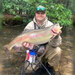
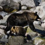
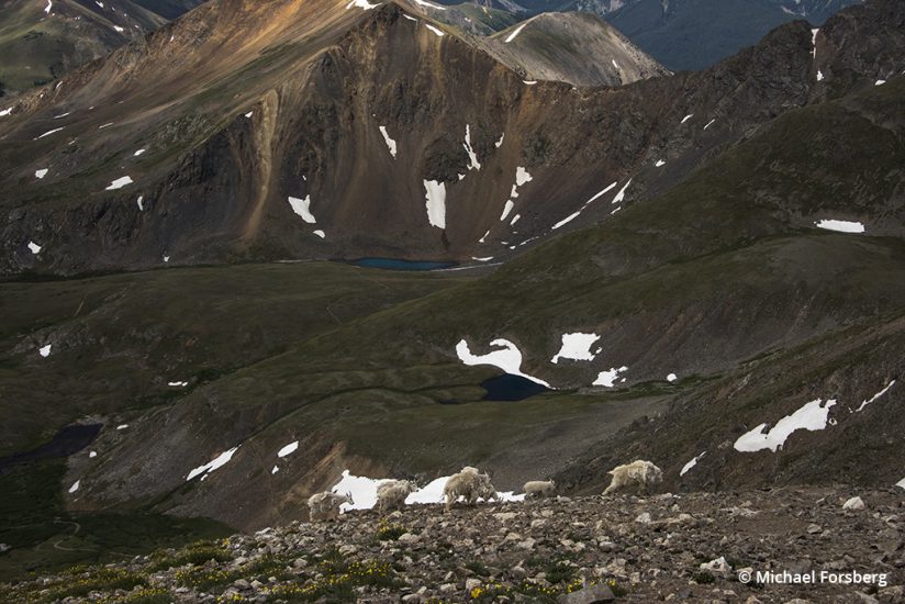
Along the way, we met ranchers and farmers, bankers and teachers, scientists and conservationists, dam operators and engineers, truck drivers, hitchhikers and tourists. We saw ample wildlife, from mountain goats to mule deer, sage grouse to American dippers, prairie dogs, river otters, bald eagles, great blue herons, cutthroat trout, catfish and mink, to name just a few.
We had many friends who served as guides or companions join us for parts of the trip. We mostly camped and cooked outside, but people we knew and even some people we didn’t would ask us into their homes to stay the night and have a meal, and a couple times we treated ourselves to a motel. We also had many good shepherds along the way—people who would advise us on roads less traveled, warn us of dangers ahead and even shuttle us to medical attention when one of us got hurt.
In the end, this was not a great wilderness adventure. We were never that far from help or civilization, and we were never in imminent danger. But even now in our 21st-century world and a country mostly filled-in, we never made a move once without water foremost on our minds. We moved with water, we camped by water, we were connected by water. Water was our lifeline.
Just after noon on day 55, the last day of our journey, we rounded a wide bend in the river and found our takeout where the Platte River confluences with the Missouri River at Schilling Wildlife Management Area, near Plattsmouth, Nebraska. And perhaps fittingly, one of the PBT time-lapse cameras that had been put in place back in 2011 when the project first started captured us as a small dot in its frame.
When we stepped out of the canoe and stood on the bank, all those memories and emotions and experiences from the past 55 days came rushing back, and tears welled up in my eyes. It was hard to make sense of it all then. But now, two years later, the take home for me is this: The Platte has a series of braided channels that go apart and come to together as it moves downstream, but they are all moving in the same direction, and they are all interconnected, and that means so is all life along a river and in a watershed, and we depend on it and each other to survive.
We all live in a watershed. Beyond all the boundaries and borders that seek to divide us, our watersheds connect us, their waters are in us, they run through us, and they are communities to which we truly belong, pulsing with life and sustaining all of us from source to sea. The next time you grab a camera and head out the door, follow the water and see where it leads.

Forsberg’s journey forms the core of a one-hour documentary film Follow the Water produced by NET Television, Nebraska’s PBS station. You can watch it at netnebraska.org.
See more of Michael Forsberg’s work at michaelforsberg.com.
The post A Braided Journey: Where Does Our Water Come From? appeared first on Outdoor Photographer.