Quaint New England towns, covered bridges, rushing rivers and granite-topped mountains provide a setting for fall color photography that will inspire you and create lasting memories. Beginning in late September at the higher elevations and continuing through mid-October in the surrounding valleys, the colorful transition from greens to yellows, oranges and reds spill down from the alpine heights of the White Mountains.
The White Mountain region consists of the northern quarter of New Hampshire and contains the most rugged scenery. Carved by glacial activity, the resulting U-shaped valleys provide road access to the three major notches from which a photographer can launch excursions. Franconia Notch, Crawford Notch and Pinkham Notch each have their own personalities, unique views and possibilities. Luckily, drive times between the different notches is around an hour, so if colors aren’t as good as you were hoping in your current location, a short drive may improve conditions.
Accessing the heart of the White Mountains is very straightforward. From the east, Maine’s Portland International Jetport is only 1.5 hours from the North Conway area via Route 113. From Logan International Airport in Boston, head 2.5 hours north on Interstate 93 toward Franconia Notch, or take Route 16 north to Pinkham and Crawford Notch. Manchester-Boston Regional Airport is New Hampshire’s largest airport and a good starting point if heading to Franconia Notch.
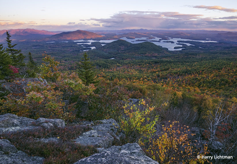
The Kancamagus Scenic Byway (New Hampshire Route 112) cuts across the state connecting the east and west portions of the White Mountains. There is no gas on this 40-mile stretch, so make sure you are fueled up before driving this section. The drive (especially Route 16 north) is scenic, passing through charming villages such as Chocorua, Tamworth and Jackson. The southern portion of the Whites reach peak color seven to 10 days later than the northern areas, so follow the colors south if time allows.
While roadside opportunities abound in the notches, I prefer to incorporate short hikes and overnight backpacking to find unique views that often include some exciting weather, clouds and lighting. Of the smaller mountains in the southern Whites, the Mount Morgan and Percival hiking loop is one of my favorites. The 5-mile hike cruises over two bald summits, with outlooks east over Squam Lake. One advantage of shooting from smaller mountains is that distant features are more recognizable in images, creating a more intimate feel.
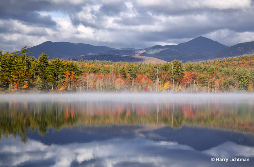
Chocorua Lake near Route 16 is a must stop if heading to the Crawford Notch area. Mts. Chocorua, Paugus, Passaconaway and Whiteface will reflect in the lake under still conditions. I prefer sunrise as the chances for fog increase. Moose are common in the area, so be careful during early morning drives.
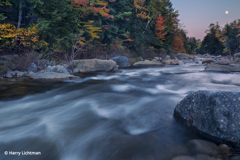
A little farther north of Lake Chocorua lies the eastern portion of the Kancamagus Highway. The Swift River hugs the road for several miles, and there is ample shoulder to park and find compositions without another photographer in sight. I like to walk the river banks to more secluded cascades and pools to increase the chances of original compositions. More popular parking areas such as Lower Falls and Rocky Gorge Scenic Area are indeed beautiful, but buses often stop here, so it can feel congested and challenging to get shots without people edging into the frame.
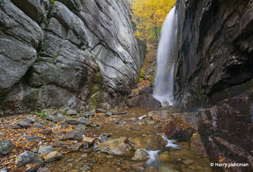
Crawford Notch
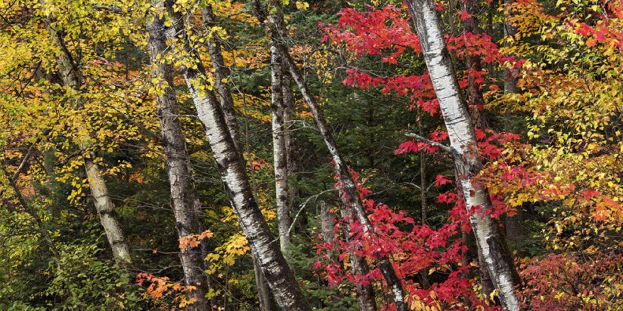
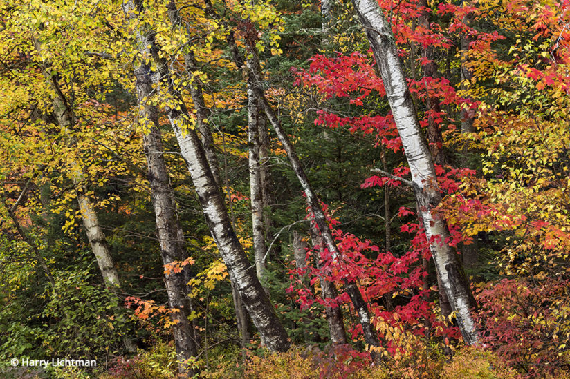
A drive through Crawford Notch is especially stunning in the autumn. This classic U-shaped valley of glacial origin boasts walls soaring nearly 2,500 feet. Webster Cliffs are composed of exposed granite outcroppings on the northeastern side of the notch, which contrast nicely with colorful foliage. Stands of paper birch frequently line the road and make for intimate shots with a zoom lens, or try a wider view to include the cliffs and sky. The Willey House is operated by the Crawford Notch State Park and offers snacks and ice cream through Columbus Day. Walk the Sam Willey Trail along the Saco River across from the Willey house to leave the busy parking area for views of 4,285-foot Mount Willey reflected in beaver ponds.
Some of the most photogenic waterfalls are found in Crawford Notch, so a little rain can be a good thing, as water flow is normally low in October. A 3-mile round trip hike, Arethusa Falls cascades nearly 200 feet over granite ledges, making it New Hampshire’s tallest waterfall. Nearby Ripley Falls is 100 feet high and can be combined with a hike to Arethusa Falls. Near the top of the notch is Silver Cascade, one of the most-photographed falls in the state. This roadside attraction is popular due to its accessibility and the proximity of vibrant maples and beech contrasting with rushing water. Numerous injuries and deaths have occurred at these falls due to slips, so use caution if moving in close for wide angle shots.
North of Crawford Notch is the Ammonoosuc River, which drains the western slopes of Mount Washington. This scenic river has beautiful pools, cascades and gorges surrounded by maples and birch. Upper Falls is a popular swimming hole just off the Cog Railway Base Road that carves its way through granite and makes a fine subject.
Pinkham Notch
North of the picturesque town of Jackson lies Pinkham Notch. When passing through Jackson, it’s worth a drive up Green Hill Road, then Iron Mountain Road to the Iron Mountain trailhead for unobstructed views of the Presidential Range and the Carter-Moriah Range. The Appalachian Mountain Club (AMC) operates a visitor center at the top of the notch where all levels of hikes originate. Views of Mount Washington and the surrounding high peaks of the Presidential Range are visible if you drive north of the AMC facility. If there is snow on the mountains, this is a good place to combine it with colorful foliage. Roadside stands of birch are also common through Pinkham Notch.
While the Tuckerman Ravine Trail is one of the most popular in the White Mountains, I prefer the nearby Boot Spur Trail for serenity and great views of Tuckerman Ravine, Mount Washington and the surrounding mountains. This is a challenging and exposed trail, so be prepared for inclement weather and a physical workout.
Franconia Notch
The Franconia Notch Parkway winds through the westernmost notch, passing Cannon Cliffs to the west and Franconia Ridge to the east. This notch gives me the big-mountain feel of the west while still in New Hampshire. Cannon Cliffs reminds me of the big walls of Yosemite as sheer granite rises 1,000 feet above. The first aerial tram in the United States was constructed on Cannon Mountain in 1938. A modern version now carries visitors to the summit for fantastic views across to Franconia Ridge. If the tram appeals to you, I recommend following the level portion of the Kinsman Ridge trail near the summit tram station for views east to the ridge.
There are several turnouts on the southbound side of the highway to access the Pemigewasset River as it tumbles over granite slabs. The Basin is a popular granite pothole formation, but a short hike further up the Basin Cascade trail will give you more options to photograph Cascade Brook as it drops over smooth granite.
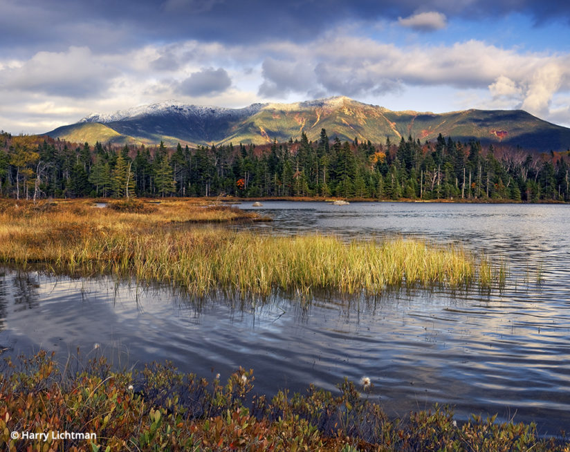
The Lonesome Lake Trail begins at Lafayette Place from Interstate 93. This is a relatively easy 1.5-mile hike that affords views of Franconia Ridge from across Lonesome Lake. This is prime moose habitat, and I frequently encounter them on early mornings or at dusk. The AMC operates the Lonesome Lake Hut adjacent to the lake and is a great option if sunrise and sunset images are in your plans.
Another wonderful AMC hut location in the area is the Greenleaf Hut, accessed from the northbound side of the Parkway across from Lafayette Place. Located on the western slopes of Mount Lafayette, this hut provides access to the alpine areas for sunrise and sunset without a long and strenuous hike by headlamp. Franconia Ridge is one of the classic alpine hikes in the White Mountains, with expansive views into the Pemigewasset Wilderness (New Hampshire’s largest) toward Mount Washington. Looking west, Cannon Mountain and Kinsman Ridge are visible. While not the most direct route to the hut, following the Falling Waters Trail is the most scenic, with the highlight being Cloudland Falls—a destination unto itself.
White Mountains: Nearby Accommodations
Hotels and motels are widely available in the White Mountain region. Jackson and North Conway are close to Pinkham Notch, while Bartlett and Twin Mountain enable easy access to Crawford Notch. Lincoln, Franconia and Woodstock are short drives to the Franconia Notch destinations.
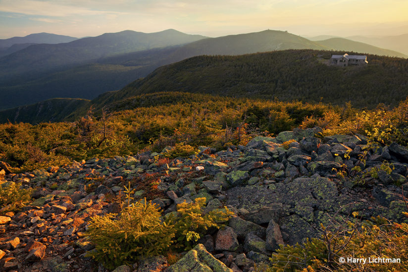
Campgrounds and AMC lodging in the notches are numerous and place you next to the trails you may want to hike. See the White Mountain National Forest section of the U.S. Forest Service website for camping options. For AMC lodging info, visit outdoors.org/lodging-camping. My bible for all things hiking- and backpacking-related in the White Mountains is the AMC White Mountain Guide, available at outdoor stores and online.
Autumn Weather In The White Mountains
The first snows can hit the higher elevations during early October, so be prepared for cold temperatures and high winds, especially if planning alpine hikes. Check the Mount Washington website (mountwashington.org) for the most accurate higher summit forecasts. The New Hampshire state website, NH.gov, posts up-to-date fall foliage forecasts for the White Mountain area. Expect cool nights, warming to the 50s or 60s at lower elevations. Morning fog is common over ponds, streams and lakes. Dress in layers and bring rain gear, and you will be able to shoot comfortably regardless of the weather. Extreme White Mountain weather can set the scene for exceptional autumn images and a trip you will not forget.
See more of Harry Lichtman’s work at harrylichtman.com.
YOU MIGHT ALSO LIKE
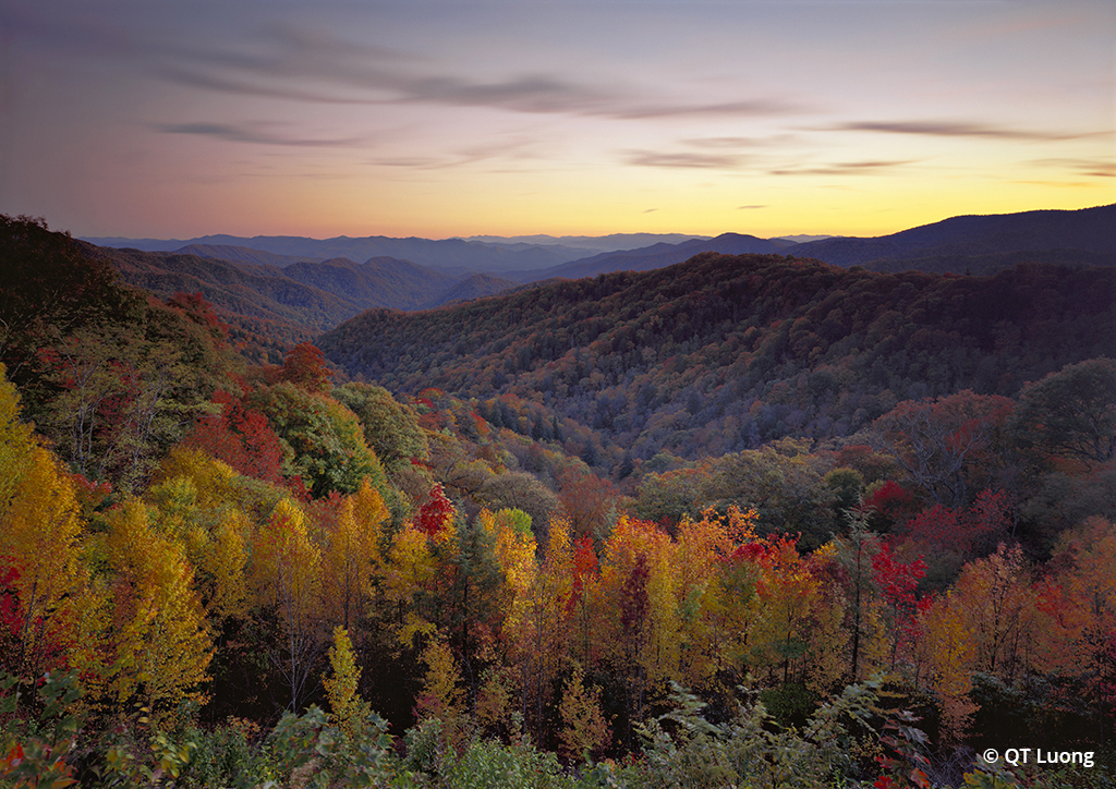
Ten National Parks For Fall Foliage
Our national parks offer incredible opportunities to capture fall colors in wilderness settings. Here are 10 favorites. Read now.
The post Colors Of The White Mountains appeared first on Outdoor Photographer.

