Florida is one of the most popular tourist destinations in the world. Our 21 million residents are joined by 120 million visitors who flock to the Sunshine State each year. Now Florida is best known for Disney World and beaches, yet its first draw was its natural attractions. Much of Florida’s original nature is still here but often hidden in plain sight of the amusement parks and coastal cities.
As a conservation photographer, I have dedicated my career to raising awareness of Florida’s lesser-known natural treasures with the purpose of inspiring their protection. I got my start as a professional photographer working with Smithsonian scientists in the rainforests of Central Africa. But after four years of expeditions on the other side of the globe witnessing relatively pristine nature, I grew increasingly concerned about the rapid loss of wildlife habitat at home and moved back to make Florida my full-time focus.
I am an eighth-generation Floridian and fortunate to have connections to our lesser-known heartland. That is where I began my photographic quest. Through photographing Florida black bears that were relying on Everglades cattle ranches, I learned from biologists how much connected habitat bears need to survive and at the same time realized how rapidly new housing developments and roads were cutting wildlife habitat into smaller and smaller pieces. I also saw that the lands of cowboys and black bears were virtually absent from Florida’s identity and were not getting the attention they deserved.
That led me to found the Florida Wildlife Corridor project, a conservation campaign working to inspire protection of a statewide network of contiguous land, 17 million acres in total, that keeps wild Florida connected. Through two major expeditions in 2012 and 2015, I have hiked, paddled and biked more than 2,000 miles through the length and width of Florida. In addition to producing books, films and numerous media stories along the way, I also added to a lifetime shot list of amazing places I want to revisit, several of which I am going to share with you now.
Wild Florida: Favorite Places
We will start our journey along the Gulf of Mexico at Caladesi State Park, a barrier island near the city of Clearwater, where I grew up. Caladesi is one of the last wild places in the most densely populated county in the Southeast and has always been an oasis for me. I developed strong connections to nature here as a boy, and it is the first place I revisited as a photographer when I came home from college. You can reach Caladesi by a ferry boat from Dunedin or by walking two miles north along the sand from Clearwater Beach (thanks to Hurricane Elena in 1985, which filled in a land bridge between the two islands).
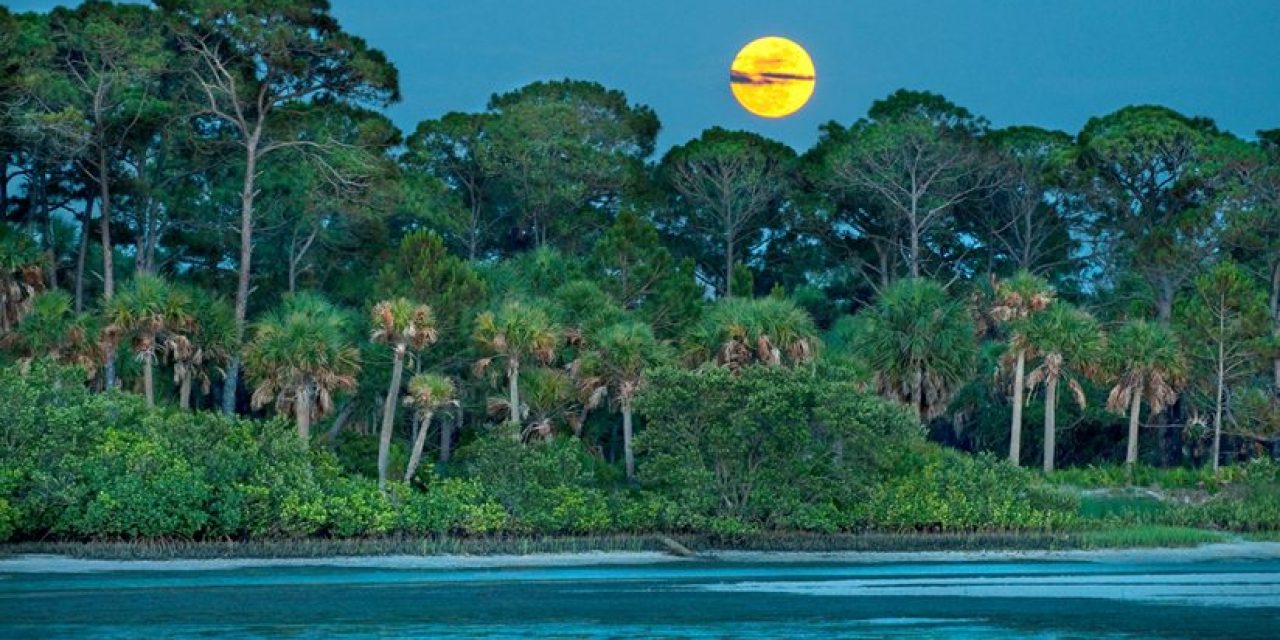
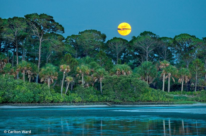
One of my favorite views of Caladesi is standing on the edge of Clearwater Beach looking east through the sand dunes across a shallow lagoon with layers of mash grasses, mangrove, palm and pines stacking toward the horizon. At dusk before the full moon, you can catch it rising just above the trees within moments of when the sun has melted into the Gulf behind you.
Caladesi Island is one of Florida’s 175 award-winning state parks. If you visit Caladesi, I recommend making the short trip to Honeymoon Island State Park and Anclote Key Preserve State Park on neighboring barrier islands. The afternoon light coming in low over the Gulf of Mexico on Florida’s west coast is the most powerful and brilliant I’ve seen anywhere in the world. In the summertime, be on the lookout for cold, dark thunderheads marching seaward over the peninsula to provide intense contrast with the warm sunset rays. The juxtaposition will awaken your senses.
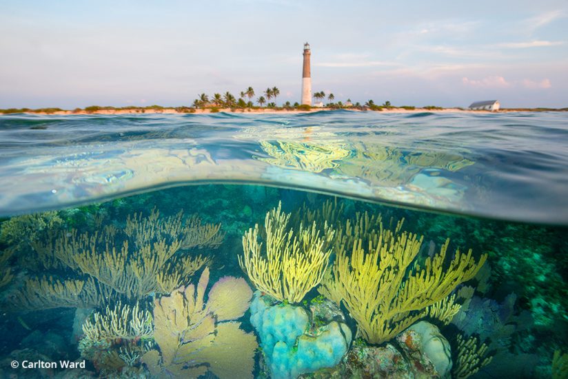
The next stop, Dry Tortugas National Park, is also on the Gulf of Mexico. Seventy miles west of Key West, this maritime outpost is as far south and west as you can go and still be in Florida. The only way to get there is by boat or seaplane, and there are regular ferries and flights from Key West. There are fantastic subjects throughout the Florida Keys, but the remoteness of the Dry Tortugas makes it one of my favorite places in the world. You can camp on Garden Key by the old fortress at Fort Jefferson and travel by boat 3 miles to the next island, Loggerhead Key, where a 150-foot lighthouse stands over the shoals and reefs where the Gulf of Mexico and Atlantic Ocean meet. If you have a water housing, you won’t want to miss the chance to explore some of America’s most vibrant coral reefs. If you have a dome port, you can try split-level shots that show the reef and either Fort Jefferson or the Loggerhead Key lighthouse in the background.
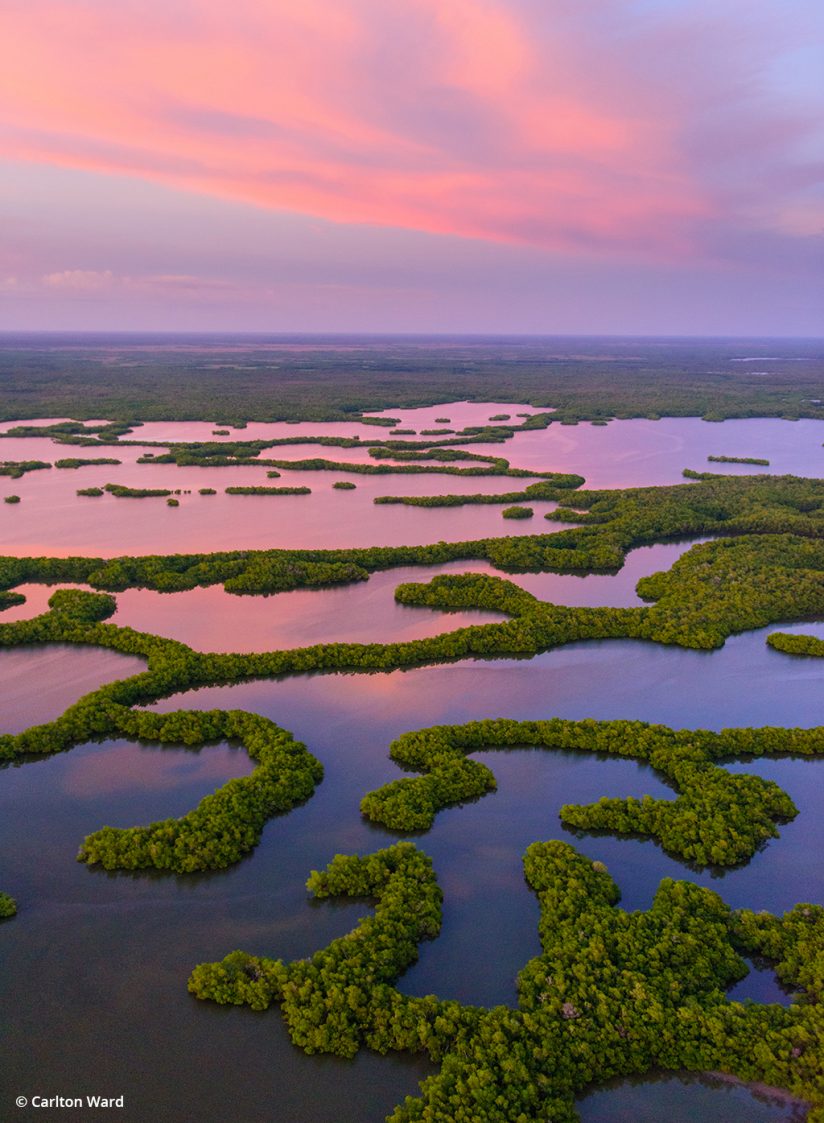
From the Dry Tortugas, we’ll travel back north across the Gulf to Everglades City. This frontier community is nestled between Ten Thousand Islands National Wildlife Refuge and Everglades National Park. Together they contribute to the largest protected mangrove coastline in the western hemisphere. From Everglades City, you can take airboat tours into the backwater creeks and sawgrass, or powerboat tours through the labyrinth of mangrove islands between the estuary and the Gulf. Some on the mangrove islands can make iconic silhouettes at sunrise and sunset with a backdrop of watery wilderness wide open to the Florida Keys and beyond. I love to see the Ten Thousand Islands from above, where you can find intricate patterns of islands and water that put the whole region in context.
For wildlife and landscape photography in the Everglades, you can’t go wrong with the Shark Valley and Anhinga Trails. Driving east from Everglades City on U.S. Route 41—one of my favorite roads with Big Cypress National Preserve on your left and Everglades National Park on your right—the Shark Valley Visitor Center is halfway to Miami, near the Miccosukee Indian outpost and airboat tours. At Shark Valley, you can hike, bike or ride a tram down a 7-mile trail straight into Shark River Slough. On a sunny day, there will be dozens of alligators to see up close along the way. At the end of the trail, there is a tall observation tower to climb for panoramic vistas of the “River of Grass.”
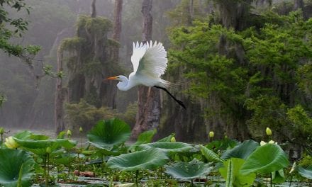
For excellent bird photography, you don’t have to walk or ride quite as far. A series of ponds and boardwalks close to the visitor center is a perfect place to see iconic water birds like anhingas, cormorants, wood storks and a variety of egrets and herons. These birds are used to seeing people, so getting close enough for a full-frame photo is not difficult. My photograph of a great blue heron in this article was taken there during an Everglades assignment for Smithsonian magazine.
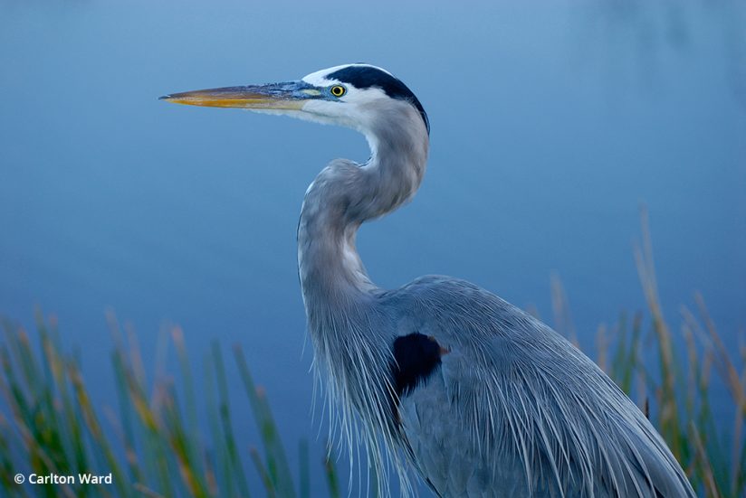
Closer to Miami, you can enter Everglades National Park from the east near Homestead. From there, the first stop for bird photography should be the Anhinga Trail. Bird sightings will be best in the dry season, typically from January through May, when less water elsewhere in the Everglades helps concentrate birds and the fish they eat around deeper ponds near the visitor centers.
The Everglades is the largest subtropical wetland in America and Florida’s best-known wilderness. With conservation areas such as Big Cypress National Preserve, Fakahatchee Strand Preserve State Park and Picayune Strand State Forest, there are 4 million acres of contiguous public land combined with Everglades National Park. But the Everglades watershed is much larger still. The headwaters of the Everglades are near Orlando within the boundaries of Disney World. The watershed encompasses nearly half of the Florida peninsula and provides water for 9 million people.
Public lands alone are not enough to protect the Everglades from suburban development that is pushing out from urban cores to accommodate 1,000 new residents moving to Florida every day. Corridors for water and wildlife are needed to keep Everglades National Park connected to its headwaters, and one important piece of the conservation puzzle is the Florida cattle ranch. America’s first cattle and horses arrived in Florida with Ponce de Leon in 1521, and ranches encompass nearly 5 million acres of Florida today. Because Florida ranches retain a lot of forest and often historic prairies, their habitat for wildlife can be as good as public parks.
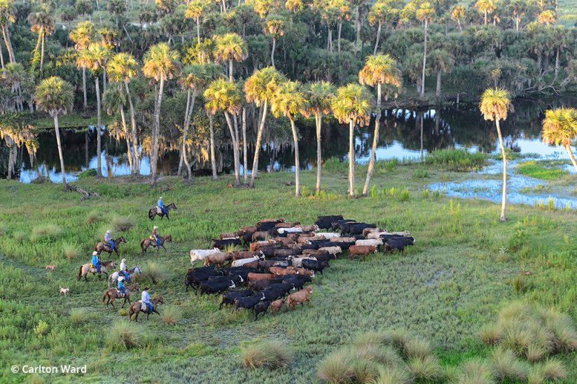
Forever Florida near Kissimmee is one place to see and learn about historic ranches. Some of Florida’s best state parks and forests were formerly cattle ranches. The St. Johns River flows north from south of Orlando to the Atlantic Ocean near Jacksonville. Florida’s longest river and second-largest watershed next to the Everglades, the upper St. Johns is largely protected by a patchwork of public lands and private ranches. One of my favorite places is Little Big Econ State Forest, where picturesque palms rise above the floodplain and line the waterways at the confluence where the Econlockhatchee River meets the St. Johns. I recommend paddling and camping along this waterway that flows east from Orlando. You might see cowboys on horseback gathering herds along the banks.
Freshwater springs might be Florida’s greatest hidden treasure. North Florida is said to have the highest concentration of freshwater springs in the world. A great place to see them is along the Florida National Scenic Trail in Ocala National Forest, where they supply pure water to the St. Johns. Or, further west, the Suwannee River and its tributaries are lined with springsheds, where crystal clear water flows up from underground aquifers. The water is 72 degrees year round, refreshing in the summer and relatively warm in the winter. Many springs provide important warm-water refuges to migrating manatees.
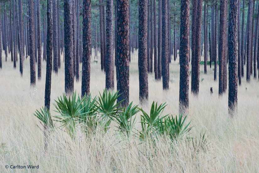
Ocala National Forest is also a fantastic place to photograph longleaf pines. This forest type once covered 90 million acres of the southeastern U.S. but was reduced by logging to just 3 million acres today. Groups like The Nature Conservancy and The Longleaf Alliance are working to restore longleaf to more of its historic range, which is critical for regional wildlife corridors. Longleaf forests and savannahs are biodiversity hotspots, with species diversity approaching that of tropical rainforests. When photographing pine forests, I enjoy using a moderate telephoto lens to compress the scene and focus on the patterns the layers of trees and grasses present. In spring when the wiregrass is seeding, the ground cover dances with texture and depth. Other great places to photograph longleaf pines are Apalachicola National Forest, Blackwater River State Forest, Eglin Air Force Base and Tall Timbers Research Center.
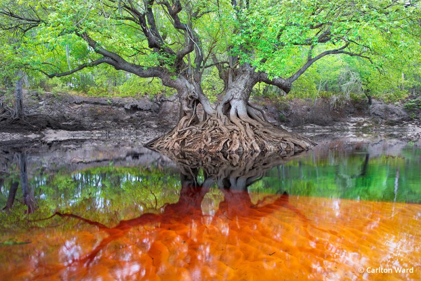
The Suwannee River originates in Okefenokee National Wildlife Refuge in southern Georgia and winds through historic longleaf country. I strongly recommend exploring its upper reaches, from Big Shoals State Park, where you can photograph flowing rapids, upstream toward the Georgia Florida line. On Day 96 of the 2012 Florida Wildlife Corridor Expedition, that’s where I photographed an Ogeechee tupelo tree in fresh spring foliage reflecting over the dark tannic waters oozing out of the Okefenokee. In the dry season, when water is low, shallow white sand bars will color the brown water orange. Carry a polarizing filter to reduce the reflection and increase saturation of vegetation and to help see through the water.
As the Suwannee flows southwest, blue spring water mixes with the dark tannic waters along the way. Awesome underwater photos can be made where the two waters converge, in places like Ginnie Springs or Manatee Springs State Park. After 240 miles, the Suwannee spreads out through Lower Suwannee National Wildlife Refuge into the Gulf of Mexico north of Cedar Key, which is a great jumping off point for freshwater and saltwater adventures. People working oyster beds in the shallows can make great subjects, as will flocks of white pelicans gathering in winter months.
This region around the Suwannee is known as Florida’s Nature Coast. Nearly 1 million acres and 160 miles of coastline are protected from north of Tampa to the Big Bend south of Tallahassee. Chassahowitzka National Wildlife Refuge, Homosassa Springs State Park, Weeki Wachee Springs State Park, Crystal River National Wildlife Refuge, Rainbow Springs State Park, Aucilla River Wildlife Management Area and St. Marks National Wildlife Refuge are just a few of the amazing places to explore.
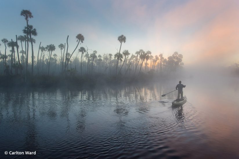
During the cooler months, magical fog often lingers over warmer springs and creeks, making for magical light. On Day 10 of the 2015 Florida Wildlife Corridor Glades to Gulf Expedition, I set my camera on a tripod and used its intervalometer to capture a photo of myself paddling off into the misty sunrise at Chassahowitzka.
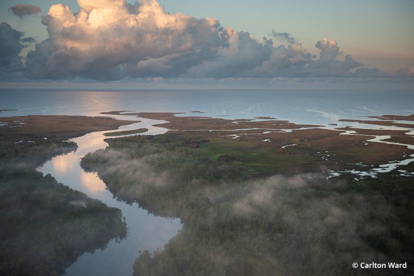
Further west, the Nature Coast transitions to the Forgotten Coast near the town of Apalachicola. This is a charming base camp complete with seafood restaurants and cafes where the Apalachicola River flows through a million acres of protected land to meet the Gulf. Shrimp boats line the docks in a town where 80 percent of households still rely on Gulf fisheries for their livelihoods. From the pristine beaches of Dr. Julian G. Bruce St. George Island State Park and St. Vincent National Wildlife Refuge to oyster boats tonging in the shallows of Apalachicola Bay to massive cypress trees lining the vast floodplain of the Apalachicola River, the challenge will be picking which subjects you want to explore first.
See more of Carlton Ward’s photography at www.carltonward.com.
The post Florida’s Hidden Wild appeared first on Outdoor Photographer.

