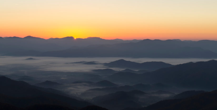
Nestled in the southern Appalachian Mountains, in the foothills of the Great Smoky Mountains, lie two communities with a common thread running right through the center of them. Franklin & Nantahala, North Carolina, are on opposite sides of the Nantahala Mountains, some of the oldest mountains in world. They also share the world famous Appalachian Trail, which begins in north Georgia, just 110 miles south of the Appalachian Trail Community town of Franklin.
The two areas, Franklin & Nantahala, NC, are located in Western North Carolina. They are towns born from gem mining and agriculture, which have over the decades transformed from the tiny rural areas, to thriving towns, welcoming adventurers of all ages to venture out into the hills and valleys of what was once known as the “Gem Capitol of the World.” The area is known world wide for our beautiful waterfalls, scenic views, and hundreds of miles of rivers, streams and lakes. Whether you’re an adventure photographer or a photographer who loves adventure, we invite you to explore a region of the country that is vastly diverse both in landscapes and activities.
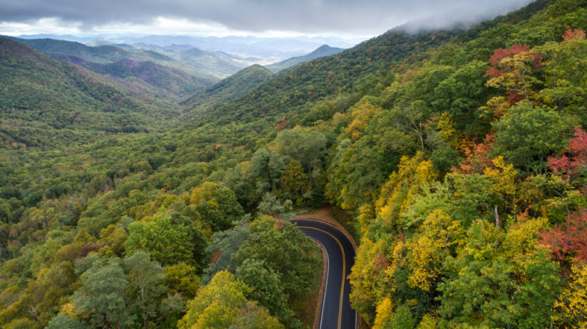
Fall is one of the most popular seasons in Franklin & Nantahala, where the multitude of colors find their way up and down the diverse elevations of the mountains. Leaf season here takes it’s time, usually peaking across the elevations over a period of weeks. With that diversity in elevation, it isn’t uncommon to experience late summer weather in the lower elevations and early winter conditions in the higher elevations on the same day. As the color changes in the leaves make their way down the mountains, the Red Maples, Sugar Maples, and White Oaks start by dotting the peaks and mountainsides earlier, saving their brilliant tones for the lower elevations until later in the season.
So where are some of the places you will want to go to get some amazing views and photography? Many of the best locations in the Franklin & Nantahala area to set out and photograph sunrise, sunset, and fall color landscapes lie within the Nantahala Mountains.
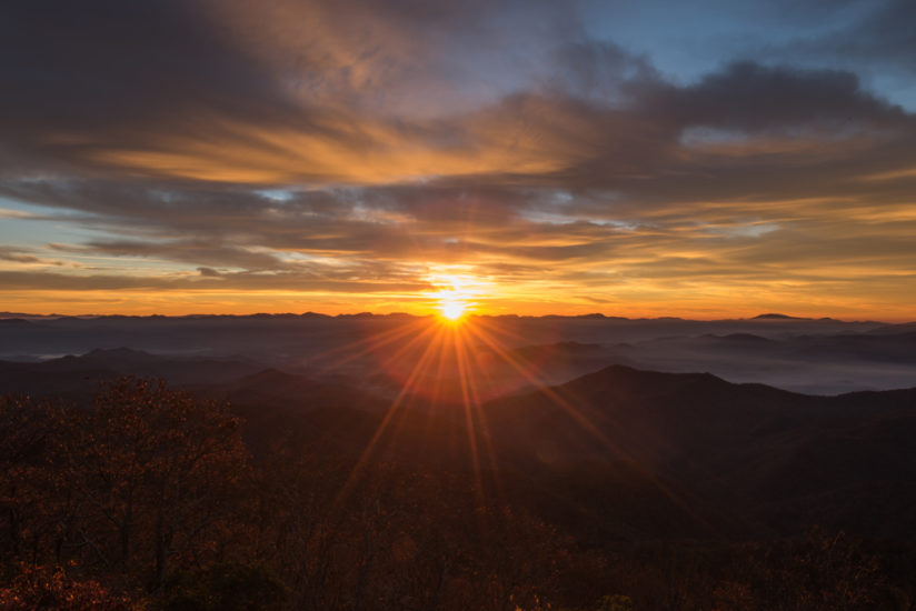
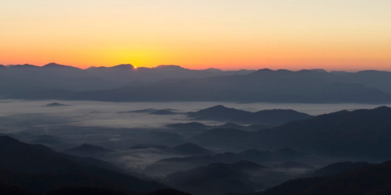
You can choose to hike to a more secluded location such as Siler Bald (Appalachian Trail), where you’ll enjoy 360-degree views allowing you a multitude of shooting options. For those wanting less hike and easier access, a drive to the Wayah Bald Lookout Tower with a wide open eastern view is the perfect location for those epic sunrise photos.
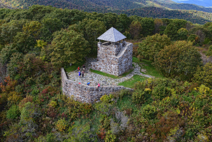
A paved path from the parking area leads you to the Look Out Tower that was originally constructed in 1933 by the Civilian Conservation Corps to act as a fire observation tower for the Nantahala National Forest. Both Siler Bald and Wayah Bald lie on the Appalachian Trail, which runs northwest to Wesser Bald and on into the Great Smoky Mountains from there.
Franklin & Nantahala are home to some of the tallest, most unique waterfalls in Western North Carolina, from the 200’ steep drop of Cullasaja Falls on the Waterfall Highway in the eastern side of Macon County, to the Upper Cascades of the Nantahala River, White Oak Creek Falls, and many more.
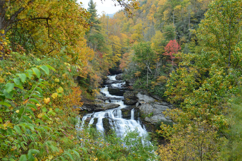
The Cullasaja River Gorge follows US 64 from Franklin east into Highlands, putting you in the heart of the most popular waterfalls and waterway in the region. With countless pull offs along the river, you’ll have plenty of opportunities to find a secluded spot to enjoy the sounds of nature while capturing its essence.
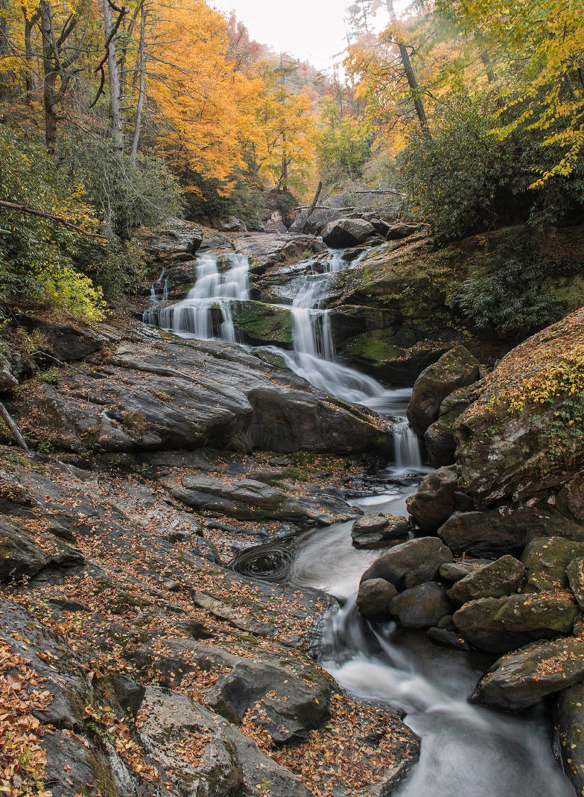
Dry Falls is a must see stop on this road. The 60-foot waterfall has an observation deck from the parking area that allows an overhead view down to the falls for some beautiful images, but the real experience is down the steps and paved path where you get to walk underneath the falls, one of the only waterfalls in the area you can do this, providing numerous angles and compositions.
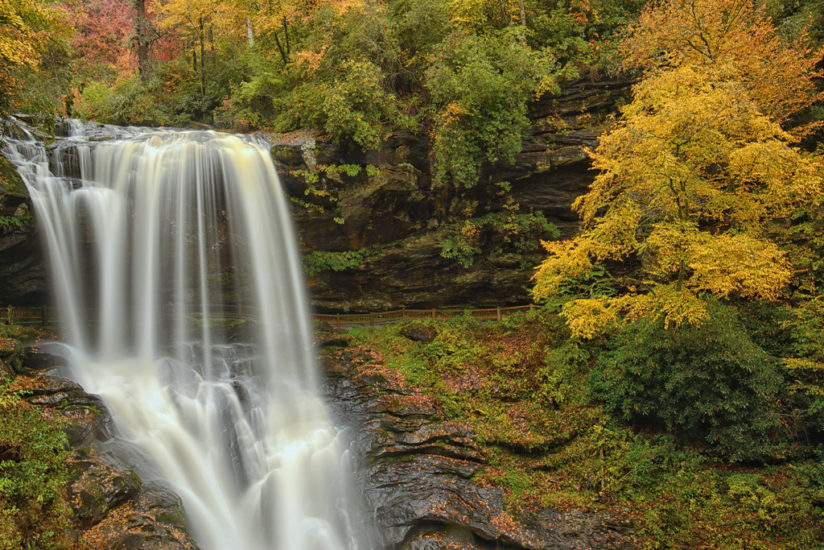
You’ll quickly see why Dry Falls is the most popular waterfall in the area, but be warned, once you experience Dry Falls, you will want to come back again and again. The area also offers opportunities for the latest medium of photography, aerial photography and video capture. Drones arepermitted in most of the areas, keeping in mind that all local, state, and federal guidelines are adhered to.
Taking a drive from Franklin over the Mountain Waters Scenic Byway will bring you over into the Nantahala Community, where Nantahala Lake and the Nantahala River will open up even more opportunities to capture the colors of fall.
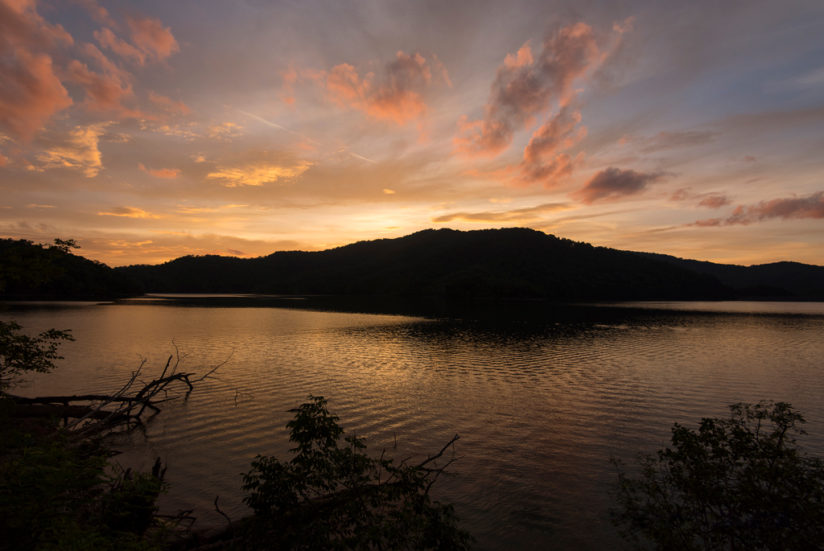
Bring a kayak, canoe, or other watercraft and put in on the pristine water of Nantahala Lake or rent the watercraft of your choosing from the local marina. Over 80 percent of the shoreline is owned by the National Forest, keeping the majority of the lakeshore free from development and the waters clean and pristine. Because of the mineral content in the soil, the lake takes on an emerald glow in shade and rich blue hues in sunlight.
Nantahala, NC is best known for the world class rapids and superior fly fishing opportunities, which makes the Nantahala River an ideal location for adventure photography. Capture the skill of kayakers as they navigate the rapids with precision.
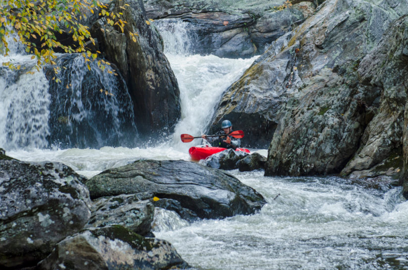
Lock in on the struggle and the exertion and the water all around. Take in the essence of the fly fisherman casting their line in the calmer waters up stream, as you make your way back to the cascades of the Nantahala River.
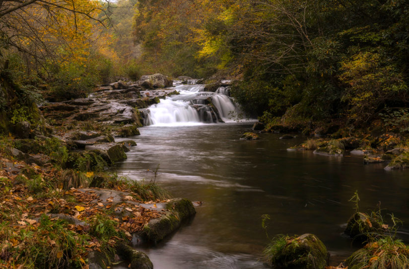
Nantahala is a small, secluded community that allows you to truly disconnect from the noise of everyday life, allowing you to immerse yourself in the moment. Many fall mornings are greeted with a low-lying fog that brings mystery and intrigue to the scenery around you.
Whether you come for a weekend or a week, once you’ve gotten a taste of the Franklin & Nantahala areas of Western North Carolina, you’re going to keep coming back again and again. The diversity of the landscape along with the proximity to the Great Smoky Mountains and The Blue Ridge Parkway make Franklin & Nantahala a perfect launching point for shooting the more popular spots of the southeast.
For information about visiting the Franklin & Nantahala areas, visit exploringwnc.com.
The post Franklin & Nantahala appeared first on Outdoor Photographer.

